
Coastal altimetry - Litto3D®
Mis à jour le 05/11/2024
Litto3D®, une cartographie continue de la frange littorale ...
En 2002, le Parlement européen et le Conseil de l'Union européenne recommandaient aux États membres de mettre en place des stratégies nationales de gestion des zones littorales afin notamment de préserver l'intégrité et le fonctionnement du milieu côtier mais également de prendre en compte les changements climatiques qui le menacent.
Dans ce cadre, le comité interministériel de la mer du 29 avril 2003 a commandé au Shom et à l'IGN un Référentiel Géographique du Littoral (RGL) dont l'objectif est de fournir une cartographie intégrée de la zone côtière.
La constitution de ce RGL repose sur l'acquisition, le traitement et la diffusion de données littorales : c'est le programme Litto3D®, destiné à combler de multiples besoins en cartographie pour :
- La protection du littoral (évolution du trait de côte sous l'effet de l'érosion, protection du domaine côtier, protection de la faune et de la flore)
- La prévention des risques (inondations, pollutions, catastrophes naturelles)
- L'aménagement (portuaire, touristique, industriel)
- L'exploitation des ressources vivantes et minérales
- Les recherches et études scientifiques
- Les besoins militaires
... basée sur une technique d'acquisition à la pointe : le LiDAR
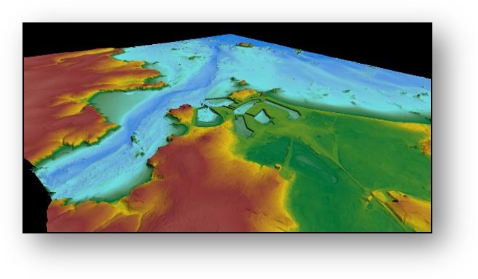
Au sein du programme Litto3D®, le Shom est en charge de la partie maritime - du haut de l'estran jusqu'à 30 mètres de profondeur. L'acquisition des données est réalisée par LiDAR : des lasers topographiques et bathymétriques aéroportés qui vont scanner le sol et les fonds marins pour en cartographier les reliefs.
- Un laser "rouge" pour les levés topographiques, concernant exclusivement les terres émergées au moment du levé.
- Deux lasers "verts" pour les levés bathymétriques, pour les terres immergées. Ces lasers présentent de nombreux intérêts comme la capacité à cartographier rapidement de grandes zones, la possibilité de sonder des zones dangereuses ou inaccessibles par voie maritime, et la facilité pour sonder en continuité la bande d’eau côtière et la zone intertidale.


Des données facilement accessibles pour répondre aux attentes des utilisateurs
Le produit est disponible sous deux formes : des semis de points tridimensionnels (sol, sursol) et des modèles numériques de terrain maillés et qualifiés (résolutions 1m et 5m), le tout structuré en dalles de 1km².
L'utilisation des données Litto3D® est ouverte, libre et gratuite (Licence Ouverte / Open License ). Elles sont disponibles en téléchargement sur diffusion.shom.fr et visualisables sur data.shom.fr (rubrique Données de référence > Altimétrie littorale).
Quelques exemples d'applications concrètes des données Litto3D®
Prévision des submersions marines
Les données Litto3D® permettent d'améliorer les capacités de prévision du système national de la Vigilance Vague Submersion opéré par Météo France.
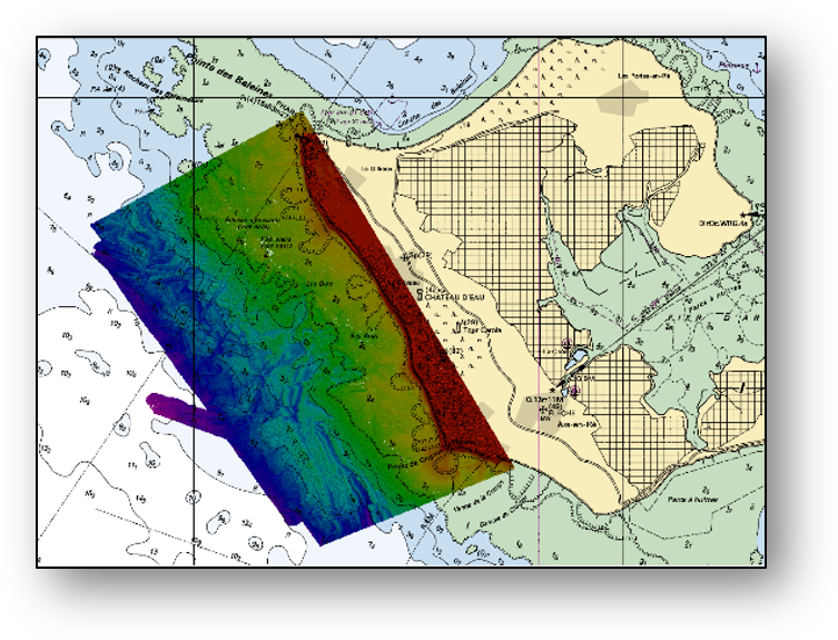
Programme d’Action pour la Prévention des Inondations
Dans le cadre du Programme d'Actions de Prévention des Inondations de Saint-Malo, les données Litto3D® Bretagne et Normandie ont été fusionnées avec les données des sondeurs acoustiques pour fournir un modèle bathymétrique haute résolution aux abords de Saint-Malo et pour tout le golfe normand-breton. Ce modèle alimentera les futures capacités de prévision des risques de submersion marine et d'inondation à terre.
Application au profit de la navigation
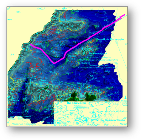
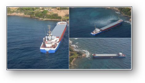
Grâce aux données Litto3D®, une route sécurisée a pu être définie pour la sortie du Rhodanus suite à son échouage sur les côtes de Corse en octobre 2019.