TRUSTED project : Shom metrology to help measure the temperature of ocean surface waters, a key indicator of climate change
Mis à jour le 06/03/2024In 2023, the Copernicus programme set a new world record for the temperature of ocean surface waters: 20.96°C*.
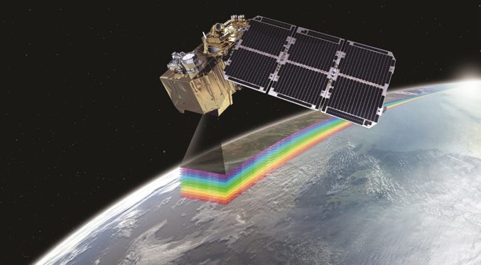
As the Earth observation component of the EU's space programme, the Copernicus programme provides precise data on the health of our planet through a satellite network called Sentinel and various ground-based measurement systems. Within this vast programme, the TRUSTED project aims to optimise satellite measurements of ocean surface water temperature.
Data from radiometers installed on satellites require multiple corrections to be reliable. The aim of TRUSTED is to validate and improve the uncertainty of the temperatures obtained by the Sentinel 3 satellites. New-generation buoys have been developed by NKE Instrumentation in Brittany, near Hennebont. Before being deployed, they are calibrated by the Shom metrology laboratory in Brest. Using a calibration tank unique in France, the buoys' various sensors are tested and characterised, before prototypes are deployed at sea using the Beautemps-Beaupré. **
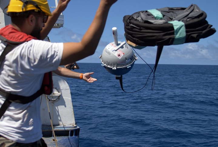
The comparisons carried out showed that they complied with the requirements of EUMETSAT, the European organisation for the operation of meteorological satellites. The project has resulted in a reference network of 150 buoys. Satisfied with the initial results, EUMETSAT has asked for 25 new buoys to be deployed by 2024, which will pass through the Shom's calibration tank before drifting over the world's oceans. Renewal of the network will continue over the coming years.
TRUSTED project extended to the Arctic Circle
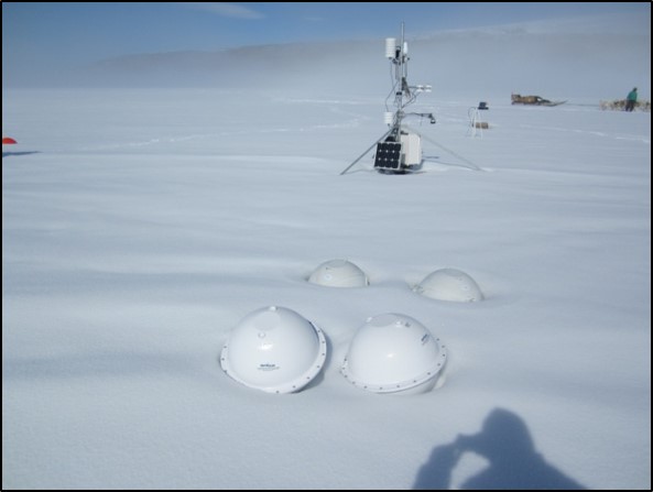
Since 2022, the Danish Meteorological Institute has been taking part in the project to develop buoys capable of taking measurements at high latitudes. Satellite measurements of sea ice surface temperatures are subject to uncertainties that need to be reduced in order to improve forecasting models.
And the challenge is huge! The ice is often covered by a layer of snow of varying depths, which causes significant differences with satellite readings due to the insulating properties of the snow. On a 20cm layer, differences of 20° can be observed !
An innovative, low-cost solution is being tested by the Shom's metrology team to solve this problem. A prototype will be validated in 2024, and the system will be implemented in the coming years.
* according to the ERA5 database. These data concern the oceans between the 60th parallel north and south, excluding the polar regions.
** The Beautemps-beaupré is the Navy's hydrographic and oceanographic vessel.
About TRUSTED
Launched in 2018, this ambitious project brings together European and French partners such as Shom in charge of the project's metrology, Météo France in charge of deploying the buoys, OceanOps in charge of managing the metadata and the company nke Instrumentation.
The German Hydrographic Service has also been involved in testing a buoy at sea. The project is being managed by CLS, a CNES subsidiary and the exclusive supplier of Argos environmental data.